After early breakfast in the hotel drive to Paro airport for flight to onward destination.
from 1 review
22 Days 21 Nights
Daily Tour
Unlimited
Any Preferred Language
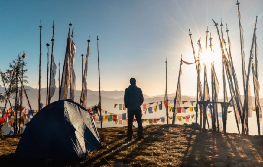
This route offers a great variety of trekking conditions, from picturesque farmland and forests to alpine pastureland and high passes. Spectacular campsites, beneath some of Bhutan’s most impressive peaks, of which the most notable are Chomolhari and Jichu Drake, are also features of this trekking route. Numerous isolated Dzongs and scattered settlements, including the extraordinary village of Laya, provide a great deal of cultural interest en route.
On arrival at Paro airport, you will be met by your Etho Metho representative and transferred to your hotel after completion of arrival formalities. Evening visit to Paro market and town. Overnight at the hotel in Paro.
Today’s full day sightseeing in Paro valley includes visits to Ta Dzong (National Museum), Rinpung Dzong (Paro Dzong) and Kyichu Lhakhang. Overnight at the hotel in Paro.
17km, 5-6 hours
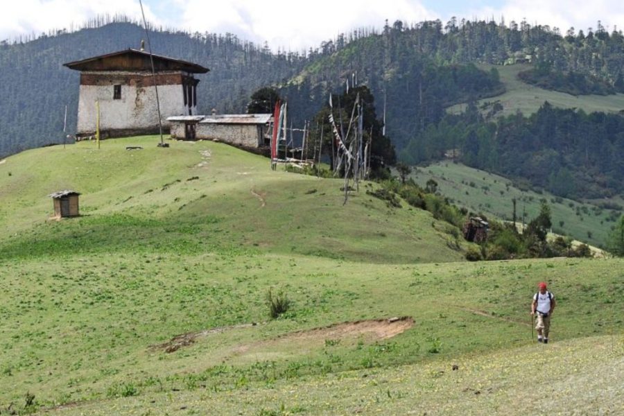
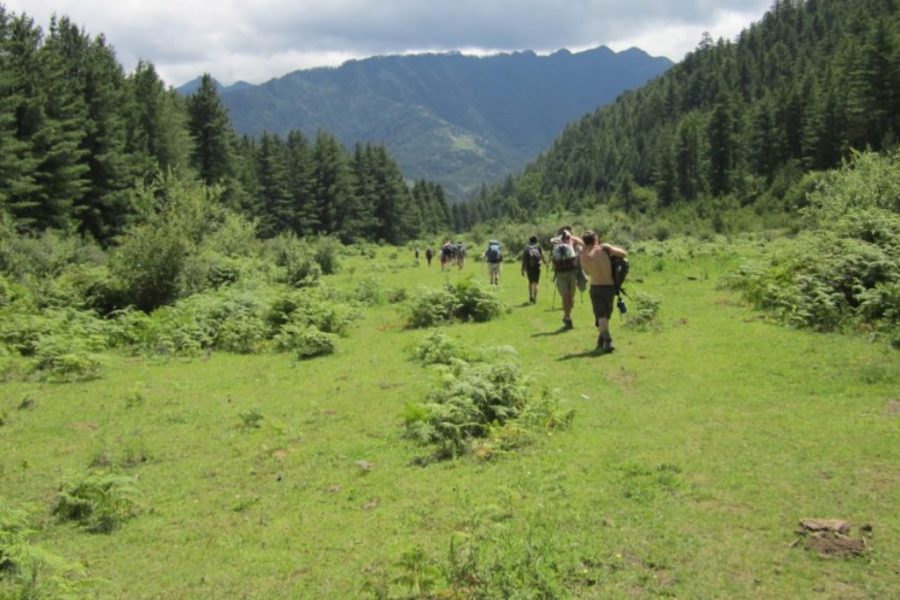
The trek starts from Drukgyel Dzong (2,580m) with a short downhill walk on a wide trail. The trail climbs gently through well-maintained rice terraces and fields of millet. The route later enters an area of apple orchards and forests. Soon the valley widens, and you reach the army post of Gunitsawa (2,810m). This is the last stop before Tibet. The trail continues up to 2,870m, just beyond Sharma Zampa, where there are several good camping places in meadows surrounded by trees.
20km, 7-8 hours
The trail again follows the Pa Chu (Paro river), ascending and descending through pine, oak and spruce forests. After crossing a bridge to the left bank of the river, we stop for a hot lunch. Then we continue along the river, climbing upwards through rhododendron forests, and crossing the river once more before reaching our campsite (3,750m).
19km, 7-8 hours
The path ascends for a while until we reach the army camp. We then follow the river above the tree line, enjoying stunning views of the surrounding peaks. Hot lunch is served at a yak herder’s camp. A short walk from here into the valley takes us to our campsite at Jangothang (4,040 m). From here, the views of Chomolhari and Jichu Drake are superb.
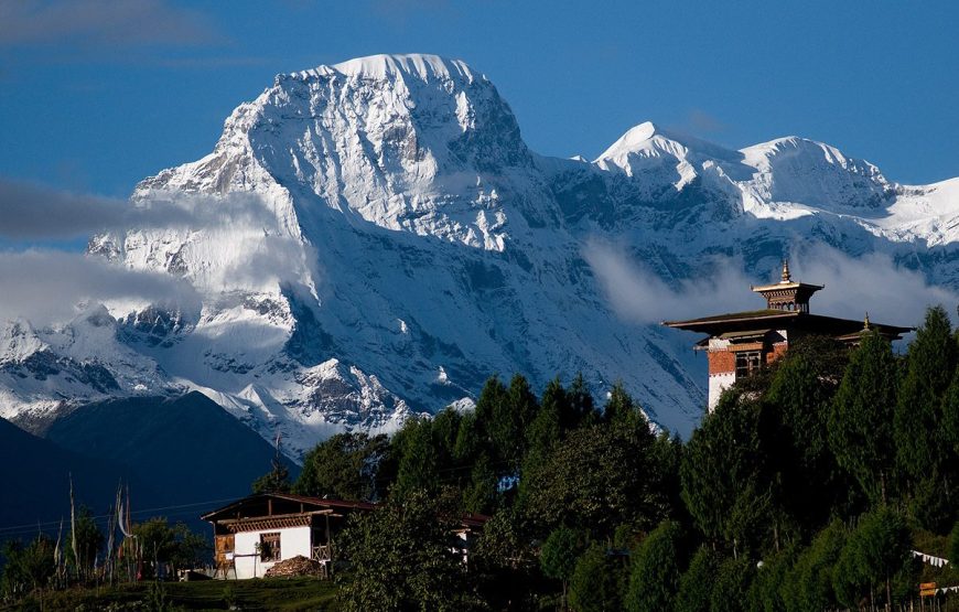
Enjoy a leisurely day at this scenic spot, enjoying a superb view of the south face of Chomolhari and the ruined dzong.
18km, 7-8 hours
The trail takes you through dwarf rhododendron trees and passes by the lake of Janetsho. Today you may come across some yak herders’ camps and get an idea of how these people live. We camp overnight close to Simkota Lake, and if you are lucky you can catch a lake trout for your dinner.
10km, 5-6 hours
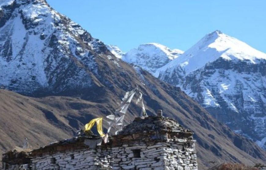
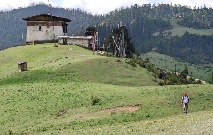
We continue on the trail past Lingshi Dzong, perched on its hilltop, enjoying exhilarating views of green hills, the winding river and magnificent peaks as we walk. It is an easy day, and a pleasant walk through villages and yak herders’ camps. After lunch, a short walk takes us to Chebisa village, where we camp by the side of a stream (3,850m).
17km, 6-7 hours
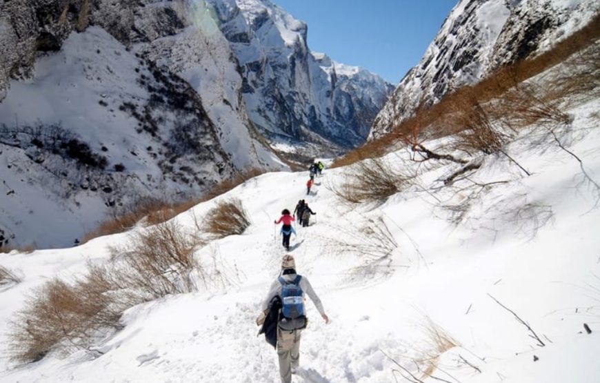
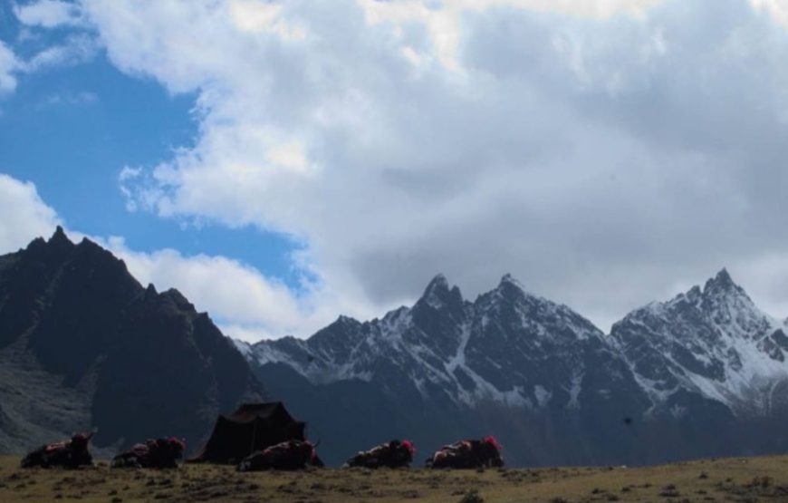
Today begins with a stiff climb of nearly four hours up a ridge to Gubu-la pass (4,500m). We descend from the pass through rhododendrons to our lunch place. We cross the stream after lunch, and continue along the up and down path, through rhododendron forests and yak herders’ camps, occasionally sighting flocks of blue sheep as we walk. Tonight’s campsite is at an altitude of 4,250m.
15km, 5 – 6 hours
The trail descends gently through a dense forest of rhododendron, birch and conifers, then drops steeply to meet the Thimphu Chu. The trail runs along the left bank of the river, climbing over ridges and descending into gullies where side streams run down into the river. The final stage of the trail climbs around a cliff face high above the Thimphu Chu, coming out onto pastureland where we camp for the night at 3,600m.
18km, 6-7 hours
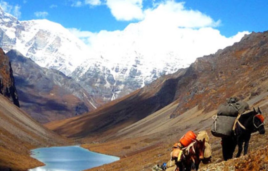
The trek starts with a climb up to Jari-la pass (4,700m). We descend from here to Tasharijathang valley, the summer grazing ground of the rare Himalayan takin (Bhutan’s national animal). We may have to ford the stream here, as the footbridge is frequently washed away. After crossing to the left bank of the stream, the trail ascends to Robluthang (4,200m) where we set up our camp for the night.
19km, 7-8 hours
We start the day with a long climb up to Shinje-la pass (4,900m), enjoying stunning mountain views from the path. After crossing the pass we descend to Limithang. The path is quite narrow, and we may have to ford the stream again and get wet. The last part of today’s trek is rather a scramble down a steep path, with the compensation of splendid views of Gangchenta peak (6,840m) along the way. Tonight we camp at 4,100m on flat ground above the river in a forested area, with Gangchenta towering directly above us to the north.
10km, 4-5 hours
In the morning we wake to a superb view of Gangchenta peak in front of our camp. The walk to Laya is very pleasant with wonderful views along the way. We pass through a damp forest, filled with moss and singing birds. We set up camp on arrival at Laya village, the second highest settlement in the country, at 3,800m.
Today we explore the village and environs. You can go and visit any of the houses around. Traditional Bhutanese hospitality is extended even to a perfect stranger, and a cup of tea and chang (an alcoholic drink) is always offered. The people in this village are very interesting, especially the women, whose plain black yak wool garments are set off by elaborate necklaces and conical bamboo hats decorated with turquoise and silver ornaments. In the evening, witness a cultural program of dances performed by village girls by the campfire, and enjoy the local alcohol (ara and chang, brewed from barley) if you have a strong stomach.
19km, 8-9 hours
We descend from Laya to the army camp at the side of the Mo Chu (Mother river of Punakha), and then walk alongside the river till reaching a bridge. After crossing the bridge, the track winds up and down through juniper and fir forests. We camp in the forest at Chamsa (3,800m).
14km, 6-7 hours
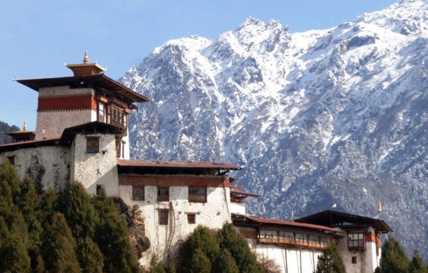
After a 30 minute walk over flat land to Bele-la pass, it’s downhill all the way to Gasa Tshachu. We take lunch at Gasa village (2700m), afterwards visiting the village and Gasa Dzong. The Dzong was built in the 17th century by Shabdrung Ngawang Namgyal, to protect the valley against Tibetan invaders. We then descend to Gasa Tshachu (hot spring), where we set up our camp (2,200m).
After a long trek, this is the place to relax! Enjoy a hot bath and try some of the local beer.
18km, 5-6 hours
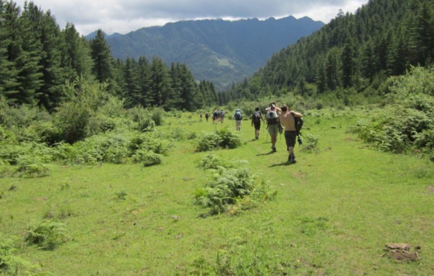
The path winds up and down through heavily forested areas where you can see many wild orchids. Take care, as there are leeches too! We camp overnight near Damji village (2,400m).
16km, 5-6 hours
This is our last trekking day. The trail descends through heavy forest, following the course of the Mo Chu, till reaching the road head at Tashithang (1,620m). Etho Metho transport will be waiting here to drive us along the valley to Punakha, 15 km. down the road. Overnight at the hotel in Punakha.
Morning sightseeing in the Punakha and Wangduephodrang valleys, visit Punakha Dzong and local market. Afternoon drive to Thimphu. Overnight at the hotel in Thimphu.
Today tour Thimphu, visiting the following as time permits: National Memorial Chorten, Tashichhodzong, National Library, Institute for Zorig Chusum (Bhutanese arts and crafts school), National Institute of Traditional Medicine (outside only), Handicrafts Emporium, Folk Heritage and National Textile Museums. Overnight at the hotel in Thimphu.
Morning for shopping and at leisure. After lunch drive to Paro visiting Semtokha Dzong en route. Overnight at the hotel in Paro.
After early breakfast in the hotel drive to Paro airport for flight to onward destination.
Bhutan is a year-round destination. There are four seasons: summer (June to August), autumn (September to November), winter (December to February) and spring (March to May). But because of the range of altitudes in the country, and the influence of the north Indian monsoons, the climate is incredibly varied.
In the south, the humid, subtropical climate is fairly consistent year-round, with temperatures between 15oC and 30oC. Central Bhutan, with its temperate forests, has a more seasonal climate, with warm summers and cool, dry winters. The northern regions are much colder during winter. Because of the high altitude, mountain peaks are snowy year-round and the lower reaches remain cool in summer.
In summer, the Indian monsoon season runs from late June or July to late September, mostly affecting the southern regions. Most farming activities take place in the summer, when crops thrive in verdant landscapes.
Autumn, from late September or early October to late November, follows the rainy season. It is characterised by bright, sunny days and some early snowfall at higher elevations. It’s the season of feasts and festivals as farmers reap the fruits of their work.
From late November until March, the crisp, clear and sunny winter sets in, with frost throughout much of the country and snowfall common above elevations of 3,000 metres. The winter northeast monsoon brings gale-force winds at the highest altitudes through high mountain passes, giving Bhutan the name Drukyul, which means Land of the Thunder Dragon in Dzongkha (Bhutan’s national language).
Bhutan’s generally dry spring starts in early March and lasts until mid-April. It is a botanist’s delight, with nature in full bloom. Summer weather commences in mid-April with occasional showers and continues to late June.
If you would like to book completely independently, there are plenty of online resources for inspiration, research and booking – including this website. There are lots of experienced, accredited tour operators that can help you too. Please check our website https://services.bhutan.travel/ for a full list of DOT-certified Tour Operators, hotels and guides.
Our host team is also on hand to help provide you with information as you plan your journey.
The country has one international airport located in Paro. Flights operated by Drukair and Bhutan Airlines arrive and depart from destinations including Bangkok, Delhi, Kolkata, Bagdogra, Bodhgaya, Dhaka, Kathmandu, Guwahati and Singapore. Private jets or charters can fly into Bhutan after obtaining the relevant approvals.
There are also domestic airports in Yonphula in eastern Bhutan, Bumthang in central Bhutan, and Gelephu in south-central Bhutan.
There are no rules about what visitors should wear. However if you are planning to visit places of religious significance, respectful smart-casual clothing that covers your body from shoulders to knees is appropriate and appreciated.